Noachis quadrangle
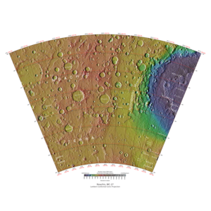
The Noachis quadrangle is one of a series of 30 quadrangle maps of Mars used by the United States Geological Survey (USGS) Astrogeology Research Program . The Noachis quadrangle is also referred to as MC-27 (Mars Chart-27). [1]
Page Revisions
| Year | Metadata | Sections | Top Words | First Paragraph |
| 2018 |
163736 characters 14 sections 85 paragraphs 81 images 277 internal links 26 external links |
hirise 0.427 hiwish 0.402 gullies 0.231 view 0.231 program 0.228 noachis 0.226 hellas 0.217 dunes 0.165 twisted 0.137 terrain 0.132 scalloped 0.126 asimov 0.114 close 0.113 russell 0.112 sand 0.107 |
The Noachis quadrangle is one of a series of 30 quadrangle maps of Mars used by the United States Geological Survey (USGS) Astrogeology Research Program . The Noachis quadrangle is also referred to as MC-27 (Mars Chart-27). [1] |
|
| 2017 |
150940 characters 13 sections 71 paragraphs 67 images 277 internal links 26 external links |
hirise 0.410 hiwish 0.319 noachis 0.276 view 0.220 gullies 0.215 dunes 0.190 program 0.188 hellas 0.187 scalloped 0.154 asimov 0.140 russell 0.137 banded 0.128 devil 0.122 terrain 0.121 sand 0.120 |
The Noachis quadrangle is one of a series of 30 quadrangle maps of Mars used by the United States Geological Survey (USGS) Astrogeology Research Program . The Noachis quadrangle is also referred to as MC-27 (Mars Chart-27). [1] |
|
| 2016 |
136357 characters 13 sections 49 paragraphs 46 images 274 internal links 26 external links |
noachis 0.348 hirise 0.315 hellas 0.217 hiwish 0.186 dunes 0.180 asimov 0.176 banded 0.162 sand 0.151 dust 0.136 view 0.134 devil 0.132 image 0.123 program 0.123 crater 0.120 craters 0.120 |
The Noachis quadrangle is one of a series of 30 quadrangle maps of Mars used by the United States Geological Survey (USGS) Astrogeology Research Program . The Noachis quadrangle is also referred to as MC-27 (Mars Chart-27). [1] |
|
| 2015 |
143300 characters 10 sections 36 paragraphs 33 images 248 internal links 22 external links |
noachis 0.425 hirise 0.260 asimov 0.215 dust 0.166 devil 0.161 crater 0.147 craters 0.147 tracks 0.142 313 0.141 scallops 0.129 dunes 0.128 gullies 0.124 slope 0.121 devils 0.119 cracks 0.115 |
The Noachis quadrangle is one of a series of 30 quadrangle maps of Mars used by the United States Geological Survey (USGS) Astrogeology Research Program . The Noachis quadrangle is also referred to as MC-27 (Mars Chart-27). [1] |
|
| 2014 |
110392 characters 9 sections 34 paragraphs 32 images 245 internal links 18 external links |
noachis 0.390 hirise 0.278 asimov 0.230 dust 0.178 devil 0.172 craters 0.157 tracks 0.152 313 0.151 crater 0.151 scalloped 0.145 scallops 0.138 gullies 0.133 devils 0.127 cracks 0.123 image 0.118 |
The Noachis quadrangle is one of a series of 30 quadrangle maps of Mars used by the United States Geological Survey (USGS) Astrogeology Research Program . The Noachis quadrangle is also referred to as MC-27 (Mars Chart-27). [1] |
|
| 2013 |
96965 characters 7 sections 29 paragraphs 29 images 241 internal links 11 external links |
noachis 0.435 hirise 0.266 asimov 0.257 dust 0.199 devil 0.192 tracks 0.170 313 0.169 scalloped 0.162 scallops 0.154 devils 0.142 crater 0.139 image 0.132 overhang 0.131 dunes 0.131 frento 0.112 |
The Noachis quadrangle is one of a series of 30 quadrangle maps of Mars used by the United States Geological Survey (USGS) Astrogeology Research Program . The Noachis quadrangle is also referred to as MC-27 (Mars Chart-27). [1] |
|
| 2012 |
94212 characters 7 sections 29 paragraphs 27 images 238 internal links 10 external links |
noachis 0.470 hirise 0.265 asimov 0.256 dust 0.198 devil 0.191 tracks 0.169 scalloped 0.162 scallops 0.154 crater 0.146 devils 0.141 image 0.131 overhang 0.131 dunes 0.131 frento 0.112 click 0.109 |
The Noachis quadrangle is one of a series of 30 quadrangle maps of Mars used by the United States Geological Survey (USGS) Astrogeology Research Program . The Noachis quadrangle is also referred to as MC-27 (Mars Chart-27). [1] |
|
| 2011 |
44274 characters 7 sections 29 paragraphs 22 images 93 internal links 5 external links |
noachis 0.454 hirise 0.278 asimov 0.268 devil 0.201 dust 0.193 tracks 0.177 scallops 0.161 crater 0.153 image 0.137 overhang 0.137 dunes 0.137 scalloped 0.127 frento 0.117 click 0.115 devils 0.111 |
The Noachis quadrangle is one of a series of 30 quadrangle maps of Mars used by the United States Geological Survey (USGS) Astrogeology Research Program . The Noachis quadrangle is also referred to as MC-27 (Mars Chart-27). [1] |
|
| 2010 |
38981 characters 7 sections 28 paragraphs 21 images 89 internal links 4 external links |
noachis 0.431 asimov 0.278 hirise 0.272 devil 0.208 dust 0.200 scallops 0.167 dunes 0.165 tracks 0.153 crater 0.150 image 0.142 overhang 0.142 scalloped 0.132 frento 0.122 click 0.119 devils 0.115 |
The Noachis quadrangle is one of a series of 30 quadrangle maps of Mars used by the United States Geological Survey (USGS) Astrogeology Research Program . The Noachis quadrangle is also referred to as MC-27 (Mars Chart-27). [1] |
|
| 2009 |
29321 characters 3 sections 23 paragraphs 18 images 79 internal links 3 external links |
asimov 0.338 noachis 0.334 hirise 0.272 devil 0.252 dust 0.224 tracks 0.186 crater 0.173 overhang 0.172 frento 0.148 click 0.144 dunes 0.144 image 0.141 devils 0.140 kaiser 0.129 picture 0.113 |
The Noachis quadrangle covers the area from 300° to 360° west longitude and 30° to 65° south latitude on Mars . It lies between the two giant impact basins on Mars: Argyre and Hellas. Noachis is so densely covered with craters that it is considered among the oldest places on Mars. When a location on Mars is as old, it is said to be Noachian in age. |